
Tasks QRAT Can Accept
Direct tracking of missing and at-risk persons
Extended remote-area foot operations, self-sufficient to 72 hours
Systematic elimination of search areas
Guided insertion and extraction of personnel through difficult terrain
Laying of surveillance and track traps to detect movement through an area
Observation and detection tasks, by day and by night
Descent and ascent of cliffs and otherwise inaccessible ground
Establishment of communications points, repeaters, and retransmission facilities
Establishment of data networks for search headquarters and forward positions
Aerial survey of inaccessible ground, including thermal imaging
Ground search and observation under night conditions
Terrain and accessibility analysis to support search-area prioritisation
Interpretation of agency-supplied mobile network data to narrow a search area
Navigation and mapping support to search headquarters
Human Tracking
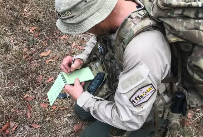
QRAT trackers use systematic ground-sign and human-tracking techniques to identify, assess, and follow indications of a person's movement through an area.
Observations are communicated and recorded factually, including relevant location, time, and other information required by the operation.
Tracking is most effective when deployed early, before sign at the search location has been disturbed or degraded.
Remote Area Search
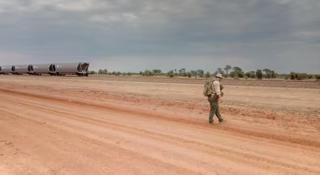
QRAT teams conduct search tasks in rugged, isolated and heavily vegetated terrain where access, navigation and endurance present additional challenges.
Personnel deploy self-sufficient for periods of 72 hours and beyond. This reduces the support burden on the requesting agency and allows teams to remain in the search area rather than travelling to and from it each day - which also keeps teams in place for the dawn and dusk periods when observation is most productive.
Field Support
Navigation and search planning.
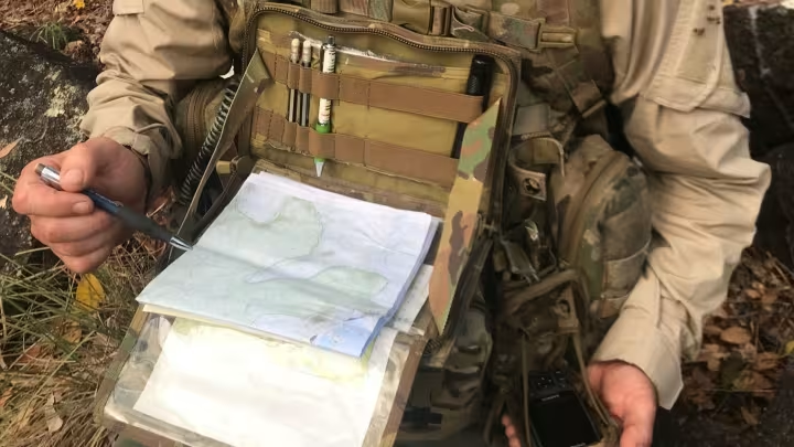
Advanced field navigation, route planning, search-area assessment, and recording of waypoints, routes and ground covered for handover to search headquarters.
Aerial observation.
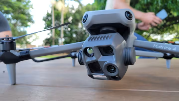
Remotely piloted aircraft for situational awareness and inspection of ground that cannot be reached quickly on foot. QRAT operates a thermal imaging payload, which detects the heat signature of a person against a cooler background.
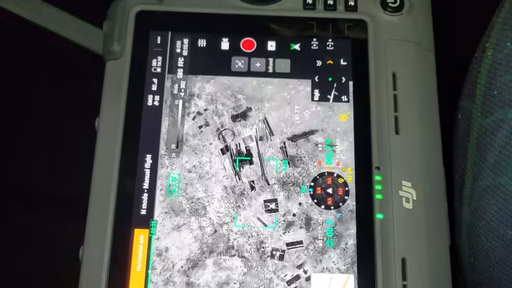
Night observation.
QRAT teams are equipped and trained for search under night conditions using handheld thermal imagers and image-intensified night observation devices.
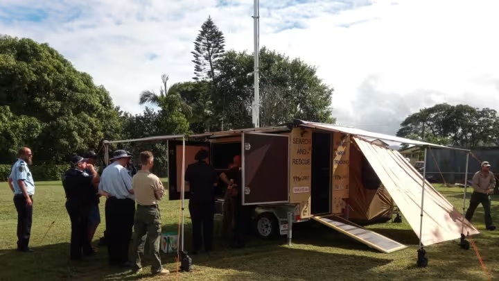
Communications.
Independent radio capability with dedicated VHF frequencies and repeaters, deployable to extend or restore communications for personnel working beyond established infrastructure. Supported by GPS, EPIRB, signal panels, and IR and white-light strobes.
Technical Support
QRAT can provide analytical and data support to a search coordinator in addition to personnel in the field. These services are delivered on agency tasking and are intended to inform the coordinator's decisions, not to replace them.
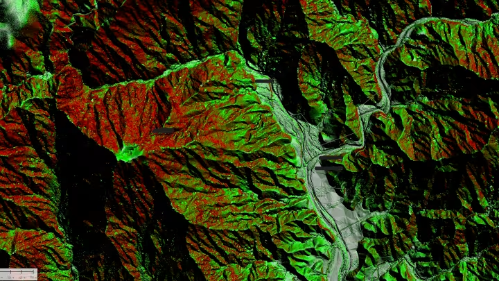
Geospatial analysis.
Terrain, landcover and accessibility modelling to support search-area prioritisation - including estimated travel distance from a last known point across real terrain rather than straight-line radius, and identification of natural boundaries, corridors and likely routes of travel.
QRAT can supply printed mapping products to search headquarters and offline map packages to field teams operating without network coverage.
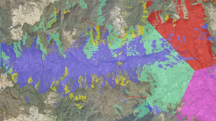
Mobile network coverage analysis.
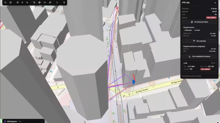
Where an investigating agency has lawfully obtained mobile network data and provides it to QRAT, QRAT can model the predicted coverage area of the sector or sectors involved against terrain and vegetation, and use that to narrow or prioritise the search area.
This work is performed only on material supplied by the tasking agency, and its output is a probability surface offered as an aid to search planning - it does not locate a person.
Emergency data networks.
Where an incident requires data as well as voice, QRAT can establish a temporary network at a search headquarters or forward position - satellite backhaul, point to multipoint network distribution, and broad-area WiFi access.
This supports live mapping, transfer of imagery and aerial video, tasking and welfare traffic, in locations with no fixed service.
Area of Operation
Primary. Mackay and the Sunshine Coast, and surrounding regions within a six-hour drive.
Secondary. Greater Queensland, subject to availability and transport arrangements.
Tertiary. Nationwide by arrangement.
Deployment and Limits
QRAT is a volunteer organisation and publishes its limits so that coordinators can task it accurately.
- Team strength. QRAT will not deploy unless a minimum viable team can attend. Availability is confirmed at the point of activation, not assumed.
- Scope. Search and rescue operations and natural-disaster response.
- Aviation. UAV tasking is subject to CASA requirements, approvals held, terrain, weather and conditions.
- Safety. No task takes precedence over safe operating conditions for personnel.
- Stand down. QRAT considers its role in an activation terminated when the tasking agency no longer requires the capability, the task is assessed as outside our scope, or minimum safe operating requirements cannot be maintained.